The Main Stretch of the Outer Banks-Kitty Hawk, Kill Devil Hills and Nags Head
The three towns located in this area of the Outer Banks are close neighbors-Kitty Hawk, Kill Devil Hills and Nags Head. All three towns share US 158 and Highway 12 (also known as the beach road). Shopping is a popular Outer Banks activity. Up and down the Bypass on Highway 158 and along the “beach road” are numerous shops. Shops with everything from beach apparel, boutiques, souvenirs shops, galleries, candy and fudge shops are found here. There is even an outlet mall located in Nags Head just as you turn left after the causeway. Whatever you need you can find here whether its clothes, souvenirs or food.
There are also many restaurants, grills, bars and breakfast nooks for all types of dining experiences. From small grills to familiar fast food chains this area has it. Plus the more fancy and expensive fine dining establishments. The local seafood items served are delicious and varied depending on the time of year.
There are numerous accommodations up and down this area. All price ranges from small quaint rooms and cottages to large national chains. Ocean front rooms, ocean view rooms, sound side views, sand dunes views or monument views, there are accommodations for everyone that will not disappoint.
Kitty Hawk
Kitty Hawk is south of Southern Shores on the Outer Banks. Established in the early 18th century the name probably comes from the Native American name Chickahawk meaning “goose hunting grounds”. Kitty Hawk is home to over 3,000 people. The beaches on the Atlantic Ocean side are wide, clean and beautiful. The sound side is peaceful and offers gorgeous nightly sunset views over the Albermarle Sound to the west.
The town of Kitty Hawk is the first town heading south on US 158 after passing over the Wright Memorial Bridge. The town has a relaxing atmosphere and has many year-round residence and as well as many year-round visitors. Kitty Hawk combines the old and the new with the Village that has been there for generations and the newer part of the community with updated beach cottages. Kitty Hawk also has Kitty Hawk Woods-a maritime forest full of coastal plant and animal life.
The first flight by the Orville and Wilbur Wright actually took place in Kill Devil Hills just about four miles south, but the telegram sent after the flight was dispatched from Kitty Hawk. So Kitty Hawk became associated with the Wright Brothers and the birthplace of aviation on the Outer Banks.
Kill Devil Hills

Kill Devil Hills is located just south of Kitty Hawk on the Outer Banks. The town got its name from one of the larger sand dunes called Kill Devil Hill. In colonial times when shipwrecks occurred near the beaches the locals would scavenge the cargo that washed ashore or that was on the ships that were grounded by the rough surf. Rum was call “Kill Devil” by the English. It is thought that rum or “Kill Devil” was hidden by the locals in the large sand dune hill-
Another theory is the town got it’s name from the Native American name Killdeer. Killdeer was the name of a bird species. This area in early times was a large hunting ground because of the abundant wildlife and fowl. With a large number of Killdeer in the area of the large sand dune or hill the name Killdeer hill may have become Kill Devil Hills. And one more theory about the town’s name refers to the moonshine that was brewed by pirates of the area, moonshine strong enough to “kill the devil”.
The largest sand dune-
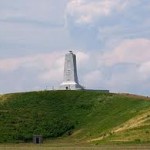
The view from the top of Kill Devil Hill is perfect with a panoramic view of the Albermarle Sound, the Atlantic Ocean and the town. Visitors can not climb the monument but the Wright Brothers National Memorial is open every day all year round except Christmas Day. The visitors center and Centennial Pavilion are open seasonally during daytime hours.
Kill Devil Hills has the Avalon Fishing Pier. It was built in 1958. It is 696 feet long extending out into the Atlantic Ocean. The pier is a popular fishing spot. The town also has a wide variety of shops and shopping centers.
Nags Head
Nags Head is just south of Kill Devil Hill located in Dare County on the Outer Banks. It is home to about 3000 people. Nags Head is the first town visitor reach on the Outer Banks if coming from the east in North Carolina on US 64 after crossing the Baum Bridge if heading north.
Nags Head is known for the high sand dunes visible for miles around. The story of how it got it’s name is as follows. Outer Bankers in the early days would hang an oil lantern around the neck of horses or mules and guide the animals across the high sand dunes luring ships at sea in too close to shore causing them to wreck or ground in the beach surf. The “old nag” with the lantern around the neck walking the high sand dunes would resemble a ship in a safe harbor. The lured ship would then sail too close to shore and become grounded and the bankers would get the cargo once the ship’s crew abandon the foundered vessel.

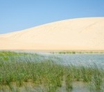
Jockey’s Ridge is the largest natural sand dune on the East Coast. Due to wind and erosion the dunes are always shifting, migrating and changing. Jockey’s Ridge State Park is a 426-
The view from the top of Jockey’s Ridge in Nags Head is beautiful with the deep blue waters of the Atlantic Ocean to the east and the peaceful and shallow waters of the Roanoke Sound to the west. The sound comes right up to the base of the dunes.
The beaches of Nags Head are popular for surfing, sun bathing and surf fishing. Pier fishing is available due to the many fishing piers located in the town. Nags Head Pier, the brand new concrete Jennette’s Pier, and the Outer Banks Pier are all located along this stretch of coastal waters. All offer a fun-filled day of fishing for the ultimate big one.

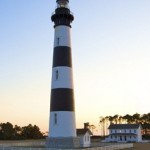
The Bodie Island Lighthouse is located in South Nags Head off South Highway 12. The 156-
Map and Location of Nags Head, Kitty Hawk and Kill Devil Hills
