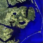
Map of Outer Banks of North Carolina
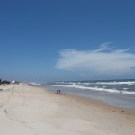
Map of Outer Banks to help navigate the area. The Outer Banks is located on the east coast of North Carolina right on the Atlantic Ocean. The states irregular coastline formed by the chain of barrier islands is quite unique. This coastal area offers many beautiful scenes due to the flat topography of the area. Scenes include beautiful sunrises over the ocean, beautiful sunsets over the sounds, long-range views of ocean water, white sandy beaches, sand dunes and sea oats.

Then there are the lighthouses that rise high up into the clear blue sky. The Bodie Island Lighthouse and the Cape Hatteras Lighthouse are especially striking as they rising above the sandy foundations and up into the sky. Both offer a breathtaking 360 degree view of ocean, sound,sand dunes and brush.
The North Carolina Outer Banks s a great place to relax, enjoy the peaceful atmosphere, listen to the gulls cry, listen to the waves breaking on the beach and soak it the warmth of the sun. Let your mind go and just take in the peaceful scenic location.
If you like excitement there is always surf fishing, pier fishing, charter boats, dune climbing, surfing, kiteboarding, SUP, sightseeing, lighthouse climbing and so much more. The Cape Hatteras National Seashore is a popular destination. And the remote island and village of Ocracoke is just a fun ferry ride away! The North Carolina Outer Banks is the place to be for a summer vacation. And don’t forget to bring the camera.
The area is an easy place to get around. The main roads are Highway 12, Highway 64, the beach road and Highway 158. But the roads can take you so some of the most beautiful places on earth! Hope the map of outer banks can be useful in you’re getting around the North Carolina Outer Banks.
Kinnakeet, NC


