
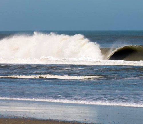
Get current Outer Banks weather conditions here. The current conditions and detailed forecasts are listed. Know the weather conditions before you travel. Know the weather conditions at your favorite beach location. Before you head out for fishing, water sports, or just need to know the weather conditions for your vacation, check out Outer Banks weather here!
Find Outer Banks Webcams Here!
Nags Head, NC
79°
Feels like: 82°FMostly Cloudy
6:52 am6:55 pm EDT
Wind: 6mph SE
Humidity: 76%
Pressure: 30.06"Hg
UV index: 6
2 pm3 pm4 pm5 pm6 pm
77°F
79°F
77°F
77°F
75°F
79°F
77°F
77°F
75°F
ThuFriSatSunMon
79°F / 73°F
79°F / 72°F
79°F / 70°F
77°F / 70°F
77°F / 70°F
79°F / 72°F
79°F / 70°F
77°F / 70°F
77°F / 70°F
Weather forecast for today
Today, on Wednesday, September 25, partly cloudy weather is expected.
A subtle difference will be noticeable between the daytime peak temperature of a moderately hot 80.6°F and the nighttime low of an agreeable 71.6°F.
The maximum heat index, which calculates the temperature value influenced by the moisture in the air, is evaluated at a hot 86°F. Note that heat index values are valued for light wind and location in the shade.
The day's peak temperature is anticipated to coincide with the standard September temperature of 77.7°F.
Sunrise was at 6:52 am and sunset will be at 6:55 pm; the daylight will last for 12h and 4min.
Weather forecast for tomorrow
Tomorrow, on Thursday, cloudy weather is anticipated.
The highest daytime temperature will reach a moderately hot 78.8°F, creating a slight contrast with the expected nighttime low of a warm 73.4°F.
The top temperature for the day will coincide with the average maximum in September of 77.7°F.
Sunrise will be at 6:52 am and sunset at 6:54 pm; tomorrow's daylight will last for 12h and 1min.
Long term weather forecast
The weather will be unstable for the next ten days, and a mix of cloudy, rainy, sunny and stormy weather is predicted.
Rainfall is expected on Friday, Sunday through Tuesday. With moderate precipitation of 0.55", most rainfall is expected on Friday.
Temperature variation will be noticeable in the next ten days. The highest temperature will range between 68°F and 80.6°F, while the lowest nightly temperature fluctuation will be also substantial, as the lowest temperature will range between 60.8°F and 73.4°F.
Today is the warmest day, with a maximum temperature of 80.6°F; next Thursday will be the coldest day, with the highest temperature of 68°F.
Today, on Wednesday, September 25, partly cloudy weather is expected.
A subtle difference will be noticeable between the daytime peak temperature of a moderately hot 80.6°F and the nighttime low of an agreeable 71.6°F.
The maximum heat index, which calculates the temperature value influenced by the moisture in the air, is evaluated at a hot 86°F. Note that heat index values are valued for light wind and location in the shade.
The day's peak temperature is anticipated to coincide with the standard September temperature of 77.7°F.
Sunrise was at 6:52 am and sunset will be at 6:55 pm; the daylight will last for 12h and 4min.
Weather forecast for tomorrow
Tomorrow, on Thursday, cloudy weather is anticipated.
The highest daytime temperature will reach a moderately hot 78.8°F, creating a slight contrast with the expected nighttime low of a warm 73.4°F.
The top temperature for the day will coincide with the average maximum in September of 77.7°F.
Sunrise will be at 6:52 am and sunset at 6:54 pm; tomorrow's daylight will last for 12h and 1min.
Long term weather forecast
The weather will be unstable for the next ten days, and a mix of cloudy, rainy, sunny and stormy weather is predicted.
Rainfall is expected on Friday, Sunday through Tuesday. With moderate precipitation of 0.55", most rainfall is expected on Friday.
Temperature variation will be noticeable in the next ten days. The highest temperature will range between 68°F and 80.6°F, while the lowest nightly temperature fluctuation will be also substantial, as the lowest temperature will range between 60.8°F and 73.4°F.
Today is the warmest day, with a maximum temperature of 80.6°F; next Thursday will be the coldest day, with the highest temperature of 68°F.
Cape Hatteras National Seashore, NC
64°
Feels like: 63°FFair
7:17 am6:14 pm EST
Wind: 9mph E
Humidity: 77%
Pressure: 30.39"Hg
UV index: 0
5 am6 am7 am8 am9 am
64°F
64°F
64°F
64°F
66°F
64°F
64°F
64°F
66°F
MonTueWedThuFri
66°F / 57°F
68°F / 63°F
70°F / 64°F
70°F / 64°F
70°F / 64°F
68°F / 63°F
70°F / 64°F
70°F / 64°F
70°F / 64°F
Weather forecast for today
Today, on Sunday, October 25, mostly clear with scattered clouds is expected. Day and night temperatures will present a subtle difference, from a maximum of a delightful 68°F to a minimum of a breezy 60.8°F. Sunrise will be at 7:17 am and sunset at 6:14 pm; the daylight will last for 10h and 58min.
Weather forecast for tomorrow
Tomorrow, in Cape Hatteras National Seashore, sunshine is also expected with little to no cloud cover. Slight temperature shifts from a high of a comfortable 66.2°F to a low of a moderate 57.2°F are predicted. Sunrise will be at 7:18 am and sunset at 6:13 pm; tomorrow's daylight will last for 10h and 55min.
Long term weather forecast
Over the next ten days, a mix of cloudy, clear and wet weather is forecasted. With minimal precipitation of 0.08", rainfall is expected on next Sunday and Monday. Temperature variation will be minimal in the upcoming period. Highs will range from 66.2°F to 71.6°F, while the minimum temperature is forecast to range between 57.2°F and 66.2°F. Next Sunday and Monday, with the highest temperature of 71.6°F, will be the warmest days; the lowest daytime temperature of the period will be reached on Monday, peaking at 66.2°F.
Today, on Sunday, October 25, mostly clear with scattered clouds is expected. Day and night temperatures will present a subtle difference, from a maximum of a delightful 68°F to a minimum of a breezy 60.8°F. Sunrise will be at 7:17 am and sunset at 6:14 pm; the daylight will last for 10h and 58min.
Weather forecast for tomorrow
Tomorrow, in Cape Hatteras National Seashore, sunshine is also expected with little to no cloud cover. Slight temperature shifts from a high of a comfortable 66.2°F to a low of a moderate 57.2°F are predicted. Sunrise will be at 7:18 am and sunset at 6:13 pm; tomorrow's daylight will last for 10h and 55min.
Long term weather forecast
Over the next ten days, a mix of cloudy, clear and wet weather is forecasted. With minimal precipitation of 0.08", rainfall is expected on next Sunday and Monday. Temperature variation will be minimal in the upcoming period. Highs will range from 66.2°F to 71.6°F, while the minimum temperature is forecast to range between 57.2°F and 66.2°F. Next Sunday and Monday, with the highest temperature of 71.6°F, will be the warmest days; the lowest daytime temperature of the period will be reached on Monday, peaking at 66.2°F.
